Preface
In April of this year (2021), we observed Rivers of Alabama Day, an annual celebration held on the second Tuesday in April. At a virtual event hosted by the Alabama Rivers Alliance, a trio of authors and activists encouraged me and other attendees to write our representatives in state government to share with them why Alabama’s rivers are important to us. Topics discussed that day ranged from recreation, to drinking water supply, to building a diverse and inclusive movement to support our communities. Here’s the link to a recording of the event.
The exercise inspired me to share a vision of how I hope our rivers—and our state—will be late in my life. Our rivers today are wonderful, and they provide us with many benefits. But they struggle with legacy problems from the 20th century and new threats due to the changing climate.
I began drafting the story immediately after the meeting. It is a fictional account set in 2050 in which the reader and I participate in a paddling expedition from Birmingham to Dauphin Island. My idea was partly inspired by the award-winning film River Dreams by Hunter Nichols. Ten years ago in 2011, Hunter paddled from Birmingham to the Gulf Coast, and shared his adventure and discoveries with us in this profoundly beautiful documentary.
With the liberty that fiction allows, I undertake the 415-mile trek in 2050 when I’m in my 80s. Along the way our expedition encounters people, places, and creatures that reveal a future for Alabama that is prosperous, inclusive, and worthy of celebration. I hope this story inspires you to help us build a future like the one I share here.
Special thanks to my friends at the Alabama Rivers Alliance for offering encouragement and feedback on this story. And much appreciation to my friend Mike Kensler at Auburn University for helping me and others understand the importance of envisioning the future we want to create.
Alabama River Journey 2050
Day 1
Launch day is finally here! In a few moments we begin our three-week paddling adventure through the heart of Alabama — from Birmingham to Dauphin Island.
It is Tuesday, April 12, 2050 — Rivers of Alabama Day. It’s a day designated by the Alabama State Legislature way back in 2007 to celebrate our state’s magnificent rivers. We’ve been planning this expedition for months, but we, and thousands of others, across Alabama have labored for decades to restore our rivers. This expedition is a mid-century celebration of all we have achieved.
Our route begins here in Birmingham, at the Mountain Brook Cahaba River Walk Park, one of the put-in/take-out points on the Cahaba Blueway water trail which opened 31 years ago in 2019. The blueway is wildly popular and paddlers keep the launch sites busy on weekends.
The park is bustling with people arriving and moving gear, canoes, and kayaks. There’s about three dozen of us launching today. The scene is like a big family reunion because many of those on the expedition have worked together for years to help revive Alabama’s rivers and build the state’s new, thriving economy. It’s hard to get our boats loaded and launched with all the handshakes and hugs.
On the expedition are state representatives, scientists, river and social justice advocates, and leaders from our business and faith communities. There are also educators here to learn about the river and bring home information and stories to their students. One of our US senators plans to join us in Mobile, and there are rumors that the governor will float with us for a few miles somewhere on the trip. And finally, we have several photographers and reporters who will be beaming updates to audiences across the Southeast and around the world during the trip!
Our journey of 415 miles will take us through some of the most beautiful and storied portions of Alabama. Our leaders are full-time professionals who guide tourists on river expeditions throughout the state. Their knowledge of the route is unrivaled, and we are excited about all we will see and learn.
From here in the Birmingham metropolitan area, we will paddle down the Cahaba River to where it joins the Alabama River near Selma. We’ll then float the Alabama River for nearly 200 river miles until it merges with the Tombigbee River to form the Mobile River. From there we’ll navigate the Mobile River Delta, better known as America’s Amazon for its vastness and diverse wildlife. The final leg of the adventure follows the western shore of Mobile Bay, crosses the Mississippi Sound, and finishes at the Dauphin Island Sea Lab on the coast.
* * *
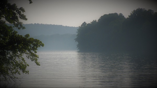
During the first hour of our float, we are busy chatting with fellow paddlers, adjusting our gear, and navigating the shoals and rapids of this headwaters section of the river. Eventually our mood calms and we begin observing more of our surroundings. The river is stunningly beautiful. Sprawling trees stretch over the stream. Flowering vines dangle from their branches. Birdsong from the forest reverberates downstream.
When I was a young professor and took my students to the river, we often brought bags to clean up the trash along the riverbank. Most of it was litter washed off our streets during storms and piped through stormwater conveyances into creeks and rivers. Litter is rare these days. There’s much less disposable packaging, and people take more pride in the beauty of their community. And when litter does happen, collection devices in our stormwater systems catch it before it reaches the stream.
In Hoover, we pass beneath the I-65 bridge. It hums with midmorning traffic. Most of the passenger vehicles are electric, though the freight trucks and many busses run on hydrogen or ammonia. Workers in Alabama factories made many of the vehicles above us, which makes us all very proud. As a result of the transportation transition, the air is far cleaner than it was decades ago. In the 2020s, several thousand people in Alabama died each year from long-term exposure to air pollution created in part by transportation. Today, it is no longer a health hazard to live near busy highways. A bonus is that the new engines are much quieter, so it is more pleasant to live near our highways and busy city streets.
The Cahaba River grows as we paddle and drift further downstream. Our canoe glides above a rocky bottom sparkling with life. Snails crowd the rocks, crayfish scurry for cover, and fish of many shapes and sizes dart quickly about. Back in the 2020s, the river would run thick with mud pollution after a rain. This would leave a layer of silt dusting the rocks on the stream bottom. Some of the silt came from construction sites with inadequate erosion controls. Much of it came from the collapse of riverbanks caused by flash flooding. Flash floods were caused by streets, roofs, and parking lots sending inordinate amounts of stormwater into our streams. It was so bad that many neighborhoods in the Birmingham metro suffered severe flooding after big rainstorms. When that water hit the streams, the floods scoured away entire habitats of the river. And the mud carried by these floods completely buried some habitats.
Today, we are careful about controlling sediment pollution during construction. And flash flooding is rare because we have adopted low impact development (LID) strategies in our urban neighborhoods. Rain gardens, green roofs, curbside trees, pocket parks, and greenways capture the rainwater at or near the site where it falls. These features improve the beauty and livability of the city, and the vegetation cools the city during our long hot summers. Importantly, LID solutions are cheaper and less disruptive to implement than digging up city streets to install larger stormwater piping. LID is an example of a multisolving approach, where the solution for one problem (flooding) is a solution for other problems (urban heating, stream degradation).
At midday we land our canoes on a gravel beach for lunch and a much-needed chance to stretch our legs. Several of us eat quickly and then don masks and snorkels, wade into the river, and slip beneath the surface. The underwater scene is dazzling. Ribbons of light dance across the rocky bottom. And we are eye-to-eye with the critters that we have been looking down on for the past few hours. Multicolored crayfish, ornately sculpted snails, and fishes of all types including darters, sunfishes, shiners, suckers, and drums. And much to my delight there are river mussels nestled amongst the rocks.
Mussels are the ecological workhorses helping us keep our rivers clean. Adult mussels can filter up to 12 gallons of water a day. They eat floating algae, and deposit silt as pellets into the riverbed. The restoration of mussel populations through reintroduction programs and improved water management across Alabama is one reason why our streams are just as clear as they were when Alabama gained statehood.
After our swim we sit on the beach to dry off and warm up in the sun. Someone spots two birds soaring over the treeline. It’s a pair of Bald Eagles, one of several that breed in the Birmingham metropolitan area. Their year-round presence in the Cahaba River Valley is one of many indications that the river and its watershed is much healthier than it was several decades ago.
Later that evening we camp out on a sandy beach. We enjoy a bonfire, delicious eats, and a variety of libations. Laughter and good cheer fill the chilly night air. Someone brought a guitar and several in our group are singing songs. Some of us retire to our tents. Others sleep beneath a starry sky.
Day 2: River Refuge
Near the end of our second day, we reach the Cahaba National Wildlife Refuge. The refuge is in the midreaches where the river widens and periodically passes over shallow rocky shoals. The shoals are magical places, alive with tumbling rivulets of water and narrow winding passages for us to navigate.
We stop at one of the shoals to walk among an expanse of flowering Cahaba Lilies. The lilies are thriving again now that flash flooding and sediment pollution is under control. Back in the 2020s they would bloom in May around Mother’s Day. But after decades of rising temperatures, the lilies and many other plants bloom much earlier than they once did.
Like many forests in Alabama, the refuge is managed under a new form of forestry for trapping and storing atmospheric carbon. Native tree species are growing into the towering giants that once dominated the forests of the Southeast. These forests also provide wildlife habitat and outdoor recreational opportunities. Because the forests capture rainwater and recharge our aquifers, they provide clean drinking water to nearby communities, keep rivers flowing during droughts, and calm the harmful flooding that became widespread as the climate shifted. Many carbon capture forests are on private lands and owners earn income to manage them with best forestry practices.
In the deeper sections between the shoals, we encounter our first schools of migrating Alabama Shad, a herring species that almost went extinct in the 2020s. Hundreds pass between our boats, zipping past us and flashing their silvery flanks. The shad grow to over a foot long and form dense schools to feed and migrate. Shad spend most of the year in coastal waters, but across the Southeast shad are now migrating upriver to spawn in shallow, rocky creeks.
Historically, migrating schools in big rivers numbered in the hundreds of thousands. They were an important source of food for Native Americans and early white settlers. Sadly, the building of dams on Alabama’s large rivers nearly drove the species to extinction. Unable to reach most of their spawning grounds, populations dwindled.
When wind and solar energy farms became widespread in Alabama in the late 2020s, it became unreasonable to maintain the state’s fleet of hydropower dams. The dams were aging, expensive to maintain, and only produced 5% of the state’s energy. Furthermore, it was cheaper to produce and save power in the new wind, solar, and battery farms. Many of the state’s large dams have been decommissioned and removed, and most of the other large dams will come down soon.
The big break for the Alabama Shad came when the US Army Corps of Engineers decided to remove its two dams on the Alabama River between the mouth of the Cahaba River and the coast. This opened hundreds of miles of access to streams and allowed several sea-run fish species like the shad to rebuild their populations.
The removal of large dams was heartbreaking for some of the state’s residents. The lakes behind those dams were popular for recreation, especially those who owned shoreline lake houses. But due to rising temperatures, the evaporation from the reservoirs frequently caused water quality to decline and water levels to drop. In addition, hydropower production became unnecessary, and the aging dams were increasingly at risk of failure. Much of the public eventually recognized that most of the state’s artificial lakes were at the end of their usefulness. But as a silver lining, the drained reservoirs are now growing new forests and are managed as public recreational lands. A restored river is the centerpiece of these parks, and those who visit enjoy hiking and biking trails, hunting, fishing, and camping.
The resurgence of fish populations is one reason that Alabama has enjoyed a boom in its tourism industry. Bass fishing tourism was already big, but now even more anglers from around the world come to Alabama to fish a variety of species including shad and sea-run Striped Bass. Other tourists come to Alabama to float its free-flowing rivers. During the warm season some of the state’s streams can get a little crowded with tourists. It’s a good problem to have.
Tourism is booming in the state for other reasons. For many decades most Alabama tourists just visited the coast. Coastal tourism is still thriving, but in the 2020s, the state developed an aggressive tourism campaign and began promoting its elite (and rightful!) status as both the birthplace of the Civil Rights Movement and the center for biodiversity in eastern North America. The state invested heavily in revitalizing and growing its network of nature and historical parks. It subsidized tourism entrepreneurship and launched a massive advertising campaign. The State’s investment more than paid for itself with the sustained growth in tourism that reached all corners of Alabama. This brought jobs and revenue to many declining rural communities. Visitors hire local guides, dine in local restaurants, sleep in hotels and bed-and-breakfasts. Whereas in 2019, spending by tourists in Alabama accounted for 7.5% of the state’s income, today tourism is 40% of the state’s GDP.
Day 6: The Confluence
It’s near the end of day 6 and we are paddling the last mile of the Cahaba River. We’ll soon be setting up camp at Old Cahawba Archeological Park, where the Cahaba joins the Alabama River. The park is the site of the state’s first capitol. During our morning meeting, our expedition leaders told us to expect a pleasant surprise where the two rivers join.
When we reach the park, we are delighted to find the Governor is there to greet us. Even better, she and an entourage of aides and reporters paddled to get here. They launched their kayaks from Selma because the Governor wanted to pass beneath the John Lewis Bridge (formerly the Edmund Pettus Bridge). One of her ancestors had crossed that bridge 85 years ago on Bloody Sunday in 1965.
The Governor had arranged a mullet fry for our dinner with her at the park. I was ecstatic because mullet is the fish I grew up eating on the coast. However, these mullet were caught by local commercial fishers on the Cahaba River. Striped Mullet had disappeared from the interior of the state when the Alabama River was dammed in the early 1970s. But like the shad, the mullet quickly rediscovered their ancient migratory river routes. Now mullet is once again part of the cultural cuisine of Central Alabama.
After chowing down on fish, hushpuppies, locally grown corn and collards, and enjoying casual conversation around the bonfire with the Governor, we fall into our tents and hammocks for some needed rest.
Day 7: The Alabama
The next morning is our first day on the Alabama River. Several others have joined our flotilla, and a tender boat powered with an electric motor now accompanies us to store extra gear and supplies.
We stop for an early lunch on the banks of Gee’s Bend, a remote teardrop of land around which the Alabama River nearly completes a full circle. At the center of the bend is the African American majority community of Boykin, and several of its citizens greet us at the park where we stopped. In the late twentieth century, the community received international attention for the quilts that women of the community had been making for over a century. This recognition was an important step in rescuing the community from decline.
The town got another boost during the Black Belt Renaissance that began in the mid-2020s. Previously, the Black Belt had been one of the most neglected and impoverished regions of the United States. Due to inadequate wastewater policies and investment, sewage regularly flooded homes or pooled into yards. Lead contaminated the drinking water. And cities from across the US shipped their waste for burial in landfills, some of which still loom over adjacent towns.
The Black Belt Renaissance was a period of widespread economic growth across the region initiated in part by a long-overdue governmental investment in people and infrastructure (e.g., broadband, wastewater treatment, drinking water, education, health care). Many Black Belt communities are now thriving. Tourists come for the museums, historical sites, shops, and restaurants. They also come to enjoy the region’s ecotourism attractions. For example, the Black Belt Birding Festival is now in its 30th year and attracts hundreds of bird- and nature-enthusiasts from around the world. It all began with a pioneering and wildly successful agritourism project at the Joe’s Black Angus Farm in Newbern, AL.
With the growth of tourism in the region, unemployment in the Black Belt has declined and retirees and young professionals who work remotely are moving into and working alongside community leaders to revitalize these rural towns. Even though property values have increased, community land trusts protect the land rights and affordable housing for the region’s long-term residents.
The quilting culture at Gee’s Bend is still thriving. Tourists from around the world visit the new Black Belt Folk Art Museum and shop galleries stocked with art and crafts created by artisans from across the Black Belt. Visiting artists attend workshops in which local quilters proudly share their history and amazing artistry. Some visitors are students of history who want to learn how this community was able to overcome decades of oppression and neglect.
* * *
Paddling on the Alabama River is a much different experience than floating the Cahaba. The river banks are far apart, and the current is strong and steady. We hug the bank because there’s more to see there and I enjoy the comfort of not being too far from shore.
Like the Cahaba, the Alabama is much cleaner than it once was. Importantly, there is far less nutrient pollution. Back in the 2020s we were adding too much nutrient waste to the river, especially from sewage treatment plants, livestock feeding operations, and stormwater runoff from farms. The long hot summers of the new climate triggered harmful algal blooms. At the coast the excess nutrients caused fish kills and dead zones in Mobile Bay.
Though it took over 50 years to get it done on the Alabama River, we finally completed the mandate set forth by the US Congress via the Clean Water Act of 1972 to make all waters of the United States “swimmable and fishable.” We had to implement new policies and technologies, but it was well worth the investment. Cleaning our rivers was an important victory for people and wildlife.
An important step in achieving this goal was Alabama’s 2024 adoption of a Comprehensive Water Plan that is one of the best in the nation. The plan’s implementation helped farmers reduce fertilizer loss from fields and reduce water use. Farmers now plant drought-tolerant crop varieties and use conservation tillage strategies to restore the soil’s water- and carbon-storage capacities. Yields are up and creeks, rivers, and estuaries are healthier. The plan was especially important during the mid-2020’s as rising temperatures and prolonged drought in California and Arizona triggered a wave of agricultural expansion in the Southeast. Thanks to the water plan, Alabama welcomed agricultural growth while protecting its streams and water quality.
Day 8: The Sturgeon Encounter
It’s midafternoon and for the past few hours our journey has been a bit monotonous. Paddle, drift, daydream, repeat.
Then behind us we hear a tremendous splash and the shouts and cheers of some of our fellow paddlers. We spin the boat around and see only the stunned faces of our friends. “What happened?!” I shout over to them. Instantly their hands spread wide in the universal gesture of ‘something big.’ Then suddenly, within just a few feet of our canoe, a colossal fish rockets from the depths, peaks at 10 feet out of the water, then splashes down with such force that you and I are showered with spray. It is a Gulf Sturgeon, a HUGE one. At least 7 feet long. While we are collecting ourselves, we hear more splashing and cheering further downstream. Apparently, we are floating over a school of migrating sturgeon.
Sturgeon once plied the rivers of the Gulf South. These were big fish, typically ranging between 6-9 feet in length. The Alabama River population once numbered several hundred thousand strong. Sadly, a combination of habitat loss and overharvesting for eggs (the eggs are salt-cured to make caviar) decimated Gulf Sturgeon populations in the early twentieth century.
Like the Alabama Shad, the Gulf Sturgeon is a sea-run fish that lives in coastal waters and spawns in rivers. Most only spawn in the same river they hatched in. With the completion of the Claiborne and Millers Ferry dams on the Alabama River in the mid-1970s, the river’s population lost access to thousands of miles of spawning habitat. With their numbers slim due to overfishing, and cut off from breeding habitat, the population in the Alabama and other Gulf rivers reached critically low levels. In 1991 the species was placed on the US Endangered Species List. Though the Alabama River population had dwindled to just a few dozen, when the dams were removed in the 2030s the population re-established its spawning migration. Conservation biologists expect the population will fully recover later this century.
Seeing the sturgeon is one of the high points of this journey for me. My great uncle was a sturgeon fisher, and I have followed efforts to rescue the species for decades. Despite all the science done this century to save the species, no one knows why they leap from the water.
Day 12 – Floodplains and fishes
We’ve passed by many miles of floodplain forests along the lower Cahaba River and the Alabama River. These are low areas that fill with floodwater when the river rises. The forests slow down this water and cleanse it of pollutants.
Because of their importance for mitigating floods, most floodplains along the state’s major rivers are under some form of protection. With the adoption of the Comprehensive Water Plan, the preservation of streamside buffers of natural habitat became statewide policy to protect rivers from mud pollution and other threats. Many larger expanses of floodplain are owned privately but are under a conservation easement ensuring the forest will be protected indefinitely. Where people farmed or lived in the floodplain, incentive programs encouraged landowners to relocate and allow for reforestation. Because flooded forests are nurseries for many river fishes, floodplain conservation is a major reason why fish and wildlife populations in the state are thriving.
The beneficiaries of these policies also include the people we see fishing along the Alabama River. Some fish from boats. Others cast from the bank. We always greet each other with smiles and waves. Several of our fellow explorers have fished every day we’ve been on the river.
Back in the 2020s when poverty was widespread, many people fished out of necessity. For the cost of some light fishing tackle and bait, one could bring home enough protein for a large family. Unfortunately, many of these fish carried dangerous pollutants, especially mercury, PCBs, and PFAS. Underregulated industries and utilities put these and other killing chemicals into rivers during the 20th and early 21st centuries. The toxins made their way up the food chain and accumulated in fishes people enjoy eating. In 2020, the Alabama Department of Public Health identified over 200 popular fishing spots on Alabama rivers where it was unsafe to eat some or all the frequently caught species. This was an environmental justice issue because the contamination impacted poor fishers the most, and the majority were Black or Latinx.
The situation is better today. Pollution levels are declining and thanks to stronger pollution policies and enforcement. In addition, thanks to a vigorous education program, most fishers know which waters and which fishes are a danger, and how to clean fish to avoid eating the parts where toxins accumulate.
Day 15 & 16 – America’s Amazon
After two weeks of paddling and drifting, we reach the merger of the Alabama and Tombigbee rivers. The confluence gives rise to the Mobile River. Everyone is excited about this milestone, in no small part because of the change in the landscape. At twice the width of the Alabama River, the Mobile River feels enormous. In truth, it carries so much water that it often cannot contain itself and several times a year—often for weeks at a time—it floods the vast swamps and floodplain forests that flank it. The river twists and turns elaborately as it navigates the delta. Every few thousand years some part of it will shift course. As a result, the delta is riddled with hidden sloughs and lakes that are the abandoned river channels. The abundance of water and ecosystems across the delta’s 390 square miles, combined with a tropical climate most of the year, makes the Mobile River Delta one of the most biologically rich places in North America. It’s moniker as America’s Amazon is well-deserved.
Within a few miles of its formation, the Mobile River splits in two. The Tensaw River flows left and east, and the Mobile River flows right and west. We camp for the night at the Mt. Vernon boat launch, just a few miles upstream of the split. The next day, we take turns riding on our tender boat 7 miles down the Tensaw River to to Bottle Creek, one of the most important Native American archeological sites in the Southeast. All that’s left of the city is 18 large mounds that arise from the soggy floodplain.
Archeologists think that Bottle Creek was the center of power for the chiefdoms of the Pensacola Culture, an empire that spanned 150 miles of the northern Gulf Coast. Native Americans built the mounds 250 years before Columbus’ famous voyage. Bottle Creek was a busy place during the 300 years of its heyday. Farmers grew maize and other crops on the surrounding floodplains, and visitors from across the region brought goods in homage or to trade. The elite ruled from their houses atop the mounds.
Today Bottle Creek sleeps beneath a thick forest blanket. As we wander respectfully among the mounds, we contemplate how disease and genocide brought by Europeans and Americans nearly annihilated the Native American cultures of the Southeast.
Fortunately, there are survivors. Some are the descendants of those who travelled the Trail of Tears in the forced relocation to what is now Oklahoma. Other descendants managed to remain in communities across the Southeast.
Native American culture in the Southeast is enjoying a revival. Some of their millennial and Generation Z activists are among the most respected leaders in the social justice and climate justice movements that blossomed in the 2020s. During recent decades several groups finally received official tribal status. And, as has happened with many indigenous people around the world, the guidance and leadership of North America’s first people has shaped our country’s transition to a less-destructive and more regenerative economy.
Day 17: Eden from ashes
The next day we resume paddling down the Mobile River. The expanse of swamp forest on either side of the river seems endless. We take time to explore some of the adjacent sloughs. Were it not for our guides, we could get lost for days in the labyrinth of side channels.
Despite its enormity and remoteness, the Mobile River Delta was struggling in the early 21st century. Decades of clearcutting in the 20th century stripped the delta of its massive cypress and gum trees. And it was frequently bathed in river water tainted with pollution arising from across the large watershed.
The delta is much healthier today. A key turning point was the purchase of huge portions of the delta through Alabama’s Forever Wild program beginning in 2001. Nearly fifty years later, the State protects 75% of the delta through the program. Two other things have helped the delta recover: pollution reduction and dam removal. The latter restored the natural seasonality of the delta’s hydrology. Thanks to these efforts, foresters predict that by the end of this century, the swamp and floodplain forests of the delta will begin to harbor trees as big as those encountered by the first European explorers who ventured into the delta hundreds of years ago.
Just two hours after breaking camp, our guides direct us to beach our boats on the right bank. After tying up our boats, we follow a narrow footpath through the forest. We come to a tall berm that seems out of place in the otherwise flat terrain. After scrambling to the top we behold a sight unlike anything most of us have ever witnessed. It is an expansive marsh measuring a full square mile in area. Hundreds of ducks erupt nearby and settle down again further away. Herons, egrets, storks, and ibises fly back and forth between their nests in the trees. They are too busy feeding hungry chicks to worry about us. Migrant shorebirds feed on the mudflats, and we spot several herds of grazing deer in the distance. A pair of Swallow-tailed Kites circle overhead. The scene is enthralling, but as our guide explains, the most impressive aspect is that this was almost the site of an ecological disaster that would have poisoned the delta for centuries to come.
These are the Barry Wetlands. They are the result of the rehabilitation of the coal ash impoundments for Plant Barry, the power plant that was once here. Coal ash contains toxic heavy metals including mercury, cadmium, arsenic, and a dozen others. The metals are at low concentrations, but large accumulations of the ash are both a physical and toxic threat to people and ecosystems.
After the failure of several coal ash impoundments in Tennessee (2008) and North Carolina (2014), federal policies and mounting public pressure forced most southern utilities to move their coal ash piles out of river floodplains. Initially, the owner of Plant Barry, Alabama Clean Energy (ACE, formerly Alabama Power), wanted to cap the waste pits with an impervious layer to reduce toxins from leaking out of the impoundments. One can understand their reluctance to move the ash because of the tremendous expense. However, capping wouldn’t have protected the impoundment from the Alabama River’s massive floods, especially those that come with the strong hurricanes that became so frequent earlier this century. If the impoundment had failed, the coal ash spill would have been an ecological catastrophe for the delta and Mobile Bay.
Fortunately, ACE chose prudence over expediency and began removing the coal ash in the early 2020s. They finished just in time, too. The floods of Hurricane Makayla in 2032—a Category 6 storm—would have washed most of the impoundment into the river. The new wetlands were designed to flood, and they weathered the storm well. As for Plant Barry, it and all of ACE’s other fossil fuel plants were replaced with wind and solar farms and battery storage power plants by 2032.
Day 18: The Clotilda and Africatown
Late in the afternoon of our eighteenth day, we reach Twelvemile Island, another site of special historical importance to the history of the Southeast. After setting up camp, our trip historian leads us to a spot along the river where we encounter a small sign on the riverbank. It reads,
“At this spot in 1860, the Clotilda was burned to the waterline. It was the last ship known to bring slaves to the United States.”
Not a lot of information, but then again, few people visit this remote location.
Our historian shares with us a more complete story. They explain that in 1860 the importation of slaves was illegal and punishable by death. Local business tycoon Timothy Meaher hired the Clotilda and its captain, William Foster, to help him smuggle a shipload of slaves from Benin to Mobile. Meaher bought 110 slaves and snuck them into Mobile Bay. He kept many for himself and distributed the rest to buyers in the area. Once the captives were offloaded, Foster brought the Clotilda to this very spot on Twelvemile Island and burned it to hide evidence of the crime.
After the Union Army liberated Mobile in 1865, some of the Clotilda’s passengers founded their own settlement near Mobile and named it Africatown. Over 185 years later, Africatown is a thriving community where the unique traditions and history of its residents are celebrated. Tourists from across the US and around the world visit daily. One of the main attractions is the Clotilda. The ship’s remains were discovered here in 2018 and then excavated and preserved. Much of the original ship, plus a full-scale replica, are on display at the National Slave Ship Memorial in Africatown.
Day 19: The Lower Delta
Excitement builds this morning as we near the top of Mobile Bay. But instead of heading directly for the bay, we head for the eastern margin of the lower delta to spend the night at Historic Blakeley State Park.
Along the way we see swamp forest giving way to lush meadows of tall reeds and acres of flowering water lilies. Gallinules—chicken-like birds with shiny-purple feathers, colorful beaks, and lanky yellow legs—strut among the vegetation. Herons, egrets, and ibises crisscross the sky. We even spy a nesting cluster of Roseate Spoonbills—tall pink birds with aptly-named beaks. Large fish swirl at the surface and turtles crowd together on every log.
In the 2030s, it looked as if we might lose the lower river delta ecosystems. As scientists had warned us since the late 20th century, sea level rise accelerated as more of the Greenland and Antarctic ice sheets melted. The rising oceans pushed marine waters of ever-higher salinities deeper into the delta. Marsh plants and trees that couldn’t tolerate the salty water died. As the vegetation died, the animals depending on them began to disappear. This ecological unraveling was happening all along the Gulf Coast.
A combination of several actions slowed the loss, and in some cases reversed the damage. First, beginning in the early 2020s, the global community quickly transitioned away from a fossil fuel-based economy. This sharply reduced greenhouse gas emissions and ensured that sea level won’t rise more than a few more inches by the end of this century (in the early 2020s scientists were warning we would see 6-8 feet of sea level rise by 2100!).
Another action saving the delta was the removal of large dams on the Alabama, Tallapoosa, and Coosa Rivers. This allowed more freshwater to flow to the coast and push back the salty tides. And the sediments and nutrients that water carried have helped rebuild the swamps and marshes.
That afternoon at Historic Blakeley State Park, we are joined by not one, but both of our senators plus a small delegation of federal officials eager to see some of the delta. After a meal around a bonfire, both senators talk about their vision of where Alabama could and should be in 2100. They mostly discuss the state’s economic evolution as it relates to our stewardship of Alabama’s land, water, and biodiversity. Though one senator is a democrat and the other a republican, their visions of the future are remarkably similar. But that comes as no surprise to anyone. The senators are good friends who frequently cooperate to push for the legislation to ensure that the US continues to lead the way in the transition to a fully regenerative economy, both domestically and abroad.
Day 20: Enter the Bay
We launch early the next morning and by midday reach the fabled Causeway—the section of Highway 98 crossing the top of the bay. We enjoy lunch and live music at the Bluegill Restaurant, which in eight years will celebrate its 100th anniversary.
The Causeway has enjoyed a full makeover since the 2020s. Seafood restaurants, fishing piers, and parks now crowd the strip. Busses shuttle tourists back and forth from hotels and other destinations in Mobile and Spanish Fort. As is now standard practice along the Gulf Coast, newer buildings can withstand storm flooding and hurricane-force winds, and be fully functional within hours to days after a major storm.
After lunch we slip into our boats and paddle beneath the bridges of Highway 98 and Interstate 10. We then enter a labyrinth of marshes constructed in the late 2020s and early 2030s. The marshes were built with spoil dredged from the deep channels that allow large ships to reach the docks and shipyards of the Port of Mobile. The dredging has damaged parts of Mobile Bay by altering the natural flow of tidal currents. However, the marshes help to offset this damage by protecting the lower delta from storm surges and the rising sea.
Constructed marshes like these elsewhere in the bay and all along the Gulf Coast, are now essential to protecting coastal settlements against erosion and storms. As a bonus, the marshes are nurseries for important seafood species including Blue Crab and several species of shrimp. The marshes have also boosted populations of Red Drum, Speckled Trout and other fishes important to commercial and recreational fisheries.
Day 21: Dauphin Island
After spending the night camping at the USS Alabama Battleship Memorial Park we break camp and launch for the last time. Today we’ll paddle along Mobile Bay’s western shore all the way to the Dauphin Island Sea Lab where our journey will end.
We are thankful for the northern tailwind since we no longer have river currents to push us along. A contingent of our flotilla swings by Gaillard Island to watch thousands of Brown Pelicans, terns, and various wading birds tend to their nests and young. By early-afternoon we are paralleling State Route 193 which connects Dauphin Island to the mainland. Thick marsh and oyster reefs built earlier this century crowd the shoreline. The reefs are a breakwater protecting the marsh from waves and erosion. They also provide habitat for marine life, including crabs and young Red Snapper. The oyster reefs grow taller as the sea surface rises. New oysters grow on old oysters—it’s that simple. Marshes also grow with sea level rise by capturing silt brought to the coast by rivers.
We pass by several oyster farms, where fishers grow the mollusks to sell to local seafood distributors. It’s a lucrative business, and each section of the bay produces oysters with their own unique flavor.
With more freshwater and less pollution in the bay, the natural oyster reefs are also thriving. Several fishers are tonging for oysters on nearby reefs. Oysters are stacked high on the decks of their flatboats. The shellfish harvested here—from the reefs and the farms—are in high demand across the Gulf South region. The fishing villages of Bayou La Batre and Coden are prospering again. And, these towns are protected from flooding by the restored marshes such as the one completed by The Nature Conservancy and its partners at Lightning Point near Bayou La Batre in 2020.
The open water between the mainland and Dauphin Island can be rough, but the wind is light and we make the crossing easily. A large shrimp boat passes us on its way to the docks. The captain slows it down to avoid causing a big wake. We offer a wave in gratitude. This is not like the shrimp boats that traversed to coast in my youth. Instead of rigging for big nets that scrape the seafloor, these boats are fitted with small cranes for hauling shrimp traps up from the bottom. Dragging nets behind boats for shrimp—known as trawling—is no longer permitted given that for every pound of shrimp harvested, 9-12 pounds of other animals were killed and discarded. Frequent casualties included sea turtles and sturgeon. Furthermore, trawling scraped small reefs off the seafloor, thereby removing valuable habitat for marine creatures.
These days, shrimpers deploy traps rigged with lights and bait to attract the shrimp as they migrate through the estuary. Most other animals are unable to enter the trap, and if they do they are released unharmed. Shrimp are now very abundant in the bay thanks to many of the improvements we’ve seen on the expedition. As a result, shrimp trapping is as productive as trawling was during the peak harvest years in the mid-twentieth century. The revitalized fishery is another demonstration that good ecology is good economy.
At long last we reach the shallows surrounding Dauphin Island, the endpoint of our journey. Like so much else, the island has changed considerably. The Gulf’s horizon, which for many decades was interrupted by oil and gas platforms, is now home to one of the coast’s largest offshore wind farms. Like many, I would prefer to see an unbroken horizon when I look out over the Gulf, but populating portions of the Alabama landscape with wind and solar farms was necessary to achieve net-zero carbon emissions.
While the eastern part of the island is stable, the so-called “West End” of the island is just a few inches above sea level and frequently flooded during storms. During the latter decades of the 20th century, many beach houses were built on the West End. Most were elevated on pilings, and during the 20th century this was sufficient to protect them from the flooding that the occasional hurricane brought. However, during the first decades of this century the changing climate caused an increase in hurricane strength and frequency and the West End seemed to be in a perpetual state of costly recovery.
The West End was abandoned in the early-2030s. Across the US, the astronomical annual cost of recovery from coastal storm damage caused by climate change forced legislative reforms in federal flood insurance policies. This withdrew incentives to build and maintain houses in flood-prone areas. Without subsidized federal flood insurance, maintaining the beach houses on the West End became financially untenable. Federal funding enabled the State of Alabama to buy the beach houses at fair market value, and pay for the removal of the houses and supporting infrastructure. It was the end of an era.
But the retreat from the West End was not the end of the story. The beaches and dunes are regularly renourished with sand dredged from nearby shipping channels. Though expensive, this is essential work to protect the estuary and the mainland from gulf waves and hurricane flooding. The State of Alabama now owns most of the West End. Several miles of beach are open to public recreation and are popular with beachgoers. More tourists enjoy the beaches of the West End than ever before. The more remote portions are set aside for wildlife.
* * *
Our excitement mounts as we paddle the last stretch to the Dauphin Island Sea Lab. As eager as we are to sleep in our own beds, we are a little regretful that this momentous adventure is ending. It’s been an adventure of a lifetime.
It’s chaotic at the beach where our flotilla lands. Boats and gear are strapped down on vehicles and trailers. There’s hugging, photos, laughter, and even a few tears. Reporters interview our expedition leaders and the sun-burned senators. But after an hour, our band of adventurers has dispersed. Some are staying with family or friends on the island for a few days. Most of us are headed back home. You and I squeeze into a shuttle to the Mobile Amtrak station. We’re taking the express train to Birmingham and will be home in time for a later dinner.
As we cross the bridge to the mainland, I look out over the wetlands, oyster reefs, and clean waters below. I enjoy the quiet joy knowing that our efforts over these past decades have created a paradise for Alabama’s residents for generations to come.
The End
How to help:
Share your vision for Alabama in the year 2050! Leave a comment here or email me directly at sduncan@bsc.edu.
Everyone can contribute to building an inclusive, thriving, and healthy Alabama. Find the values and visions that you share with your friends, family, and neighbors, then find creative ways to create the future you want. Join a community-based or statewide advocacy group focused on a topic you care about. Participate in local and state governance—our representatives need your knowledge and guidance. A better future won’t happen unless we make it happen.
Pingback: Alabama River Journey 2050 by Scot Duncan | Hydropower Reform Coalition